Headon cum Upton is one of the larger parishes in Bassetlaw, with almost 3000 acres. It contained the four hamlets – Headon, Upton, Nether Headon and Thorpe, though Thorpe is now only known through the name of a street. The village of Headon is in the centre of the parish, with Upton along the southern edge. Headon was an Anglo Saxon settlement – the “heah dun” or high hill. With the Viking invasions the hamlet of Thorpe came into being, then later there came the “up town” (Upton) and Nether Headon. Flint tools found in the parish tell us that people have lived here for at least 5000 years, while the many pieces of Roman pottery found in the fields prove that there was a settlement here in Roman times.
The village of Headon is clustered around the parish church of St Peter, which was built in about 1200. Some years ago the tomb slab of a knight in chain mail armour was discovered outside the vestry wall. This has been dated to about 1300 and most probably belonged to either Simon de Headon or his son Gerard, both of whom were sheriffs of Nottingham in the late 13th century, giving Headon a possible link to the Robin Hood legend.
Grove, a collection of approximately 50 houses, straggling along Main street, to the East of the A638 (London Road), at White Houses, has its origins in the various stages of development of a series of occupancies, possibly starting with pre-Roman tribes and certainly the Normans, through to the Harcourt-Vernons. The surroundings show many signs of this rich history, with the remains of substantial (early C12th) earth-works in Castle Hill wood, the remains of a moat in the north-east corner of the wood and the now demolished house which stood at the head of a slope with views towards Retford in the west. The last incarnation of the latter house can be seen in a photograph in the office of Malcolm’s Taxis, in the bus station in Retford. Much of the village started as estate houses, mostly built in the late 19th century and, more recently, with a flush of luxury development. The estate history is still clear in the several old farms, blacksmith’s house, school, church and Rectory which form the core of the village, as well as the tracks and roads which connect Grove to Retford.
Stokeham is a small village 6 miles from the market town of Retford with 20 properties and a current population of 51. This includes 2 working farms and a small holding, an industrial unit, a stud farm and a nursery. A small church stands at the centre of the village dating back to the 13th century and has one church service every month.
Contact details:
Name: Clare Brettell
Email: headonpc@gmail.com
Website: https://hugsparishcouncil.co.uk/
Dataset
Interactive Map
Important Note
This Interactive Map is not part of the Open Government Licence or Ordnance Survey Open Government Licence and cannot be used as such. Any downloading or copying of this data is an infringement of the Ordnance Survey Licence. For more information please see our Licensing page.
Technical Description
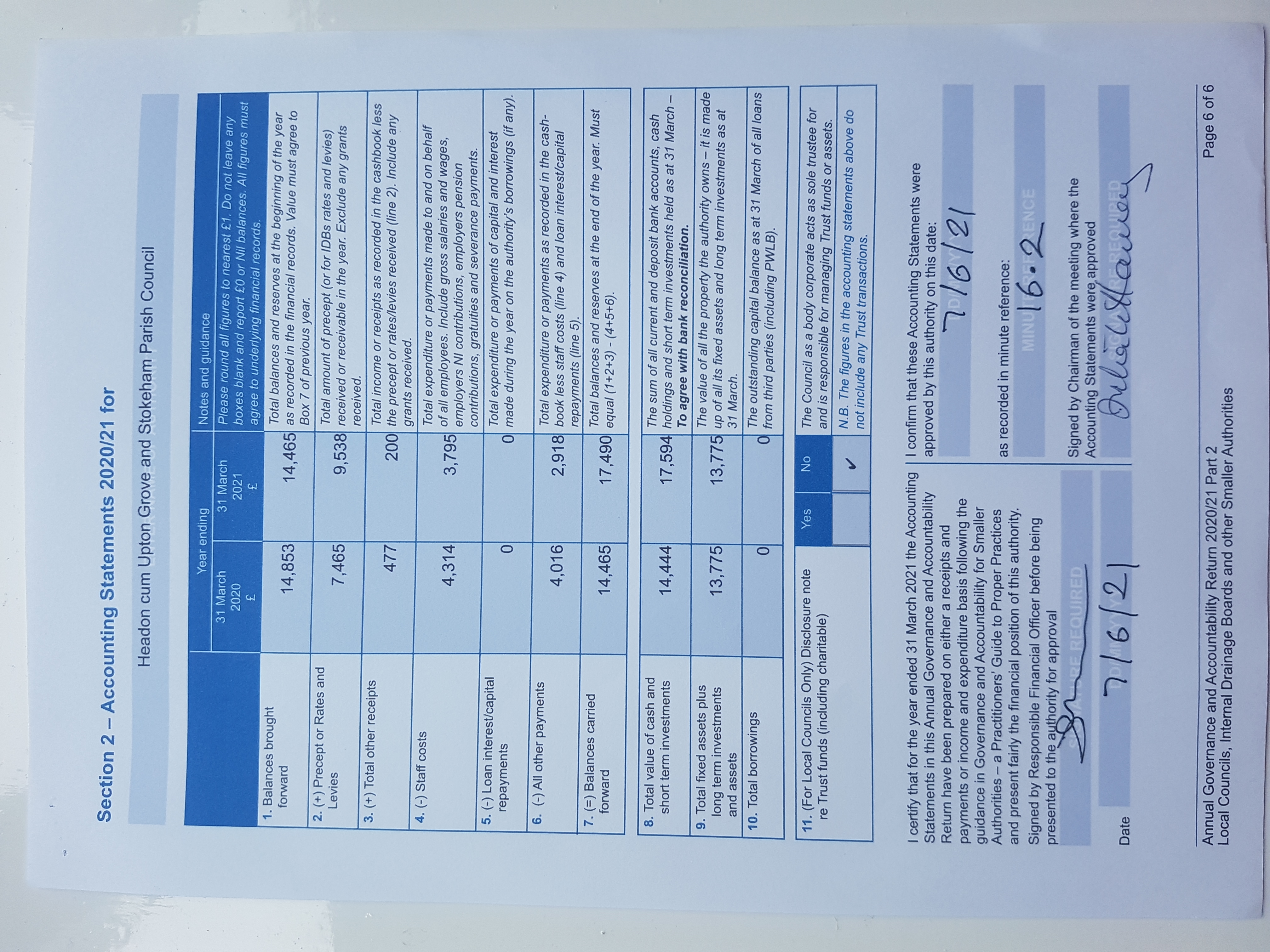
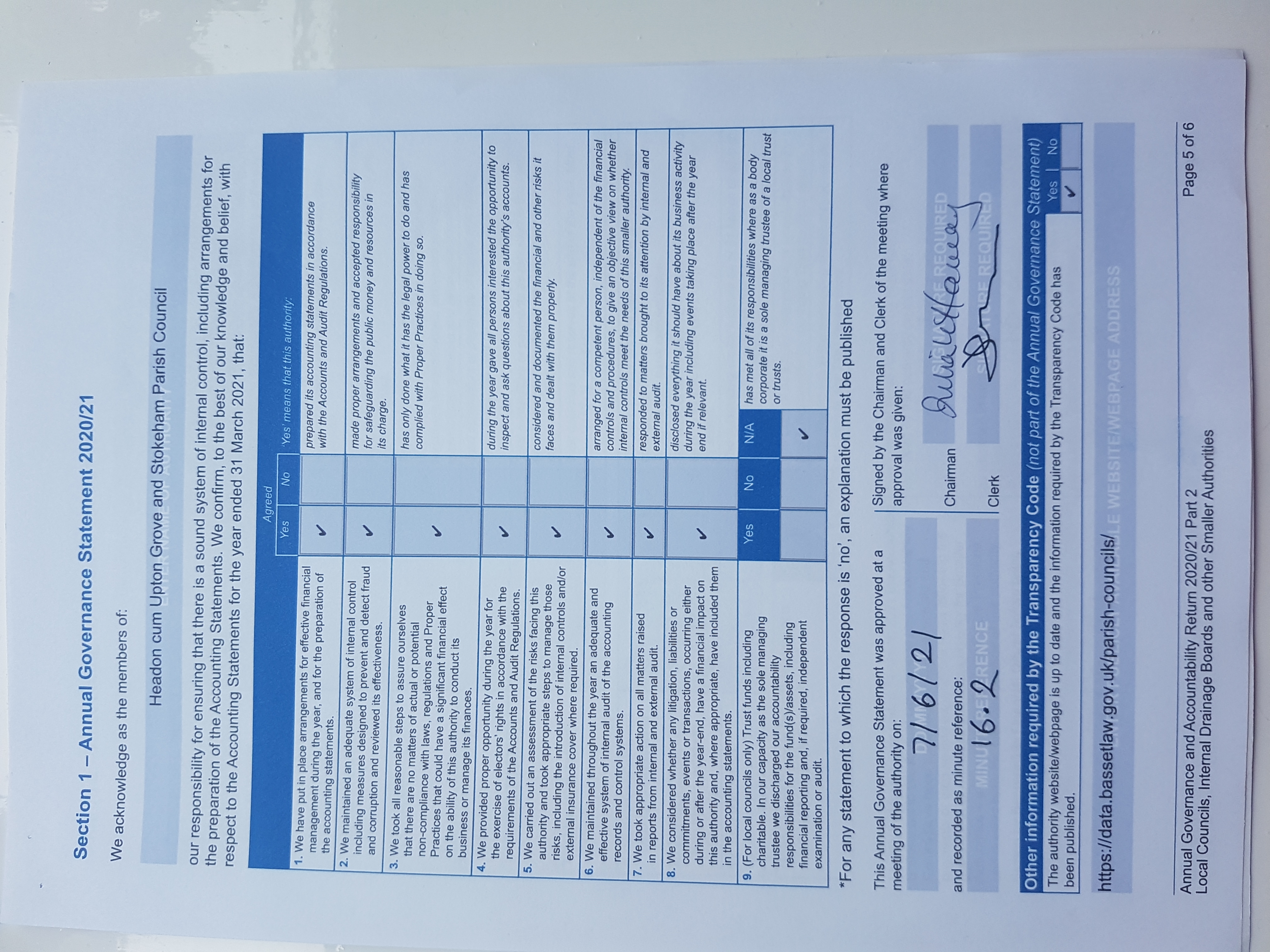
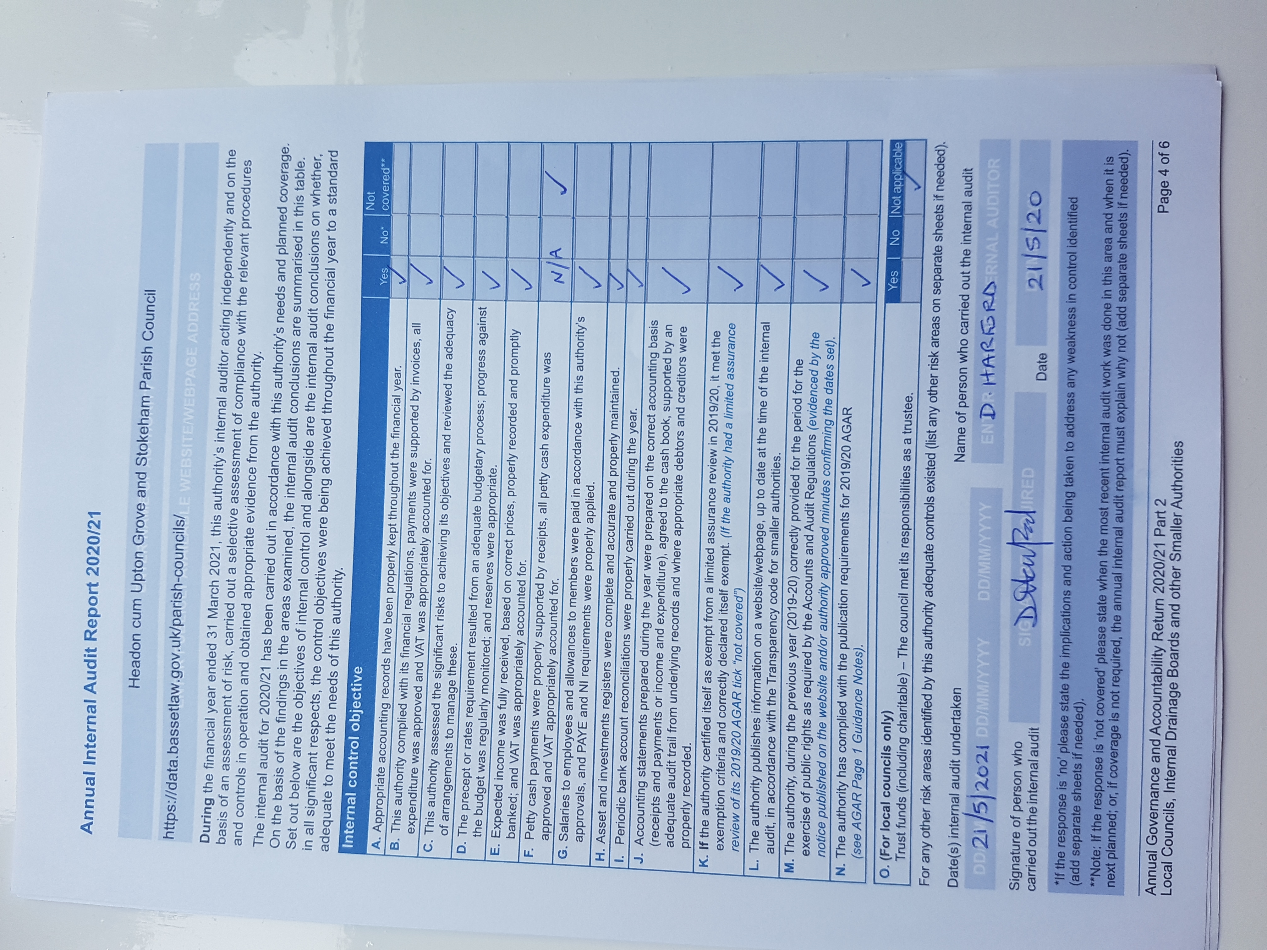
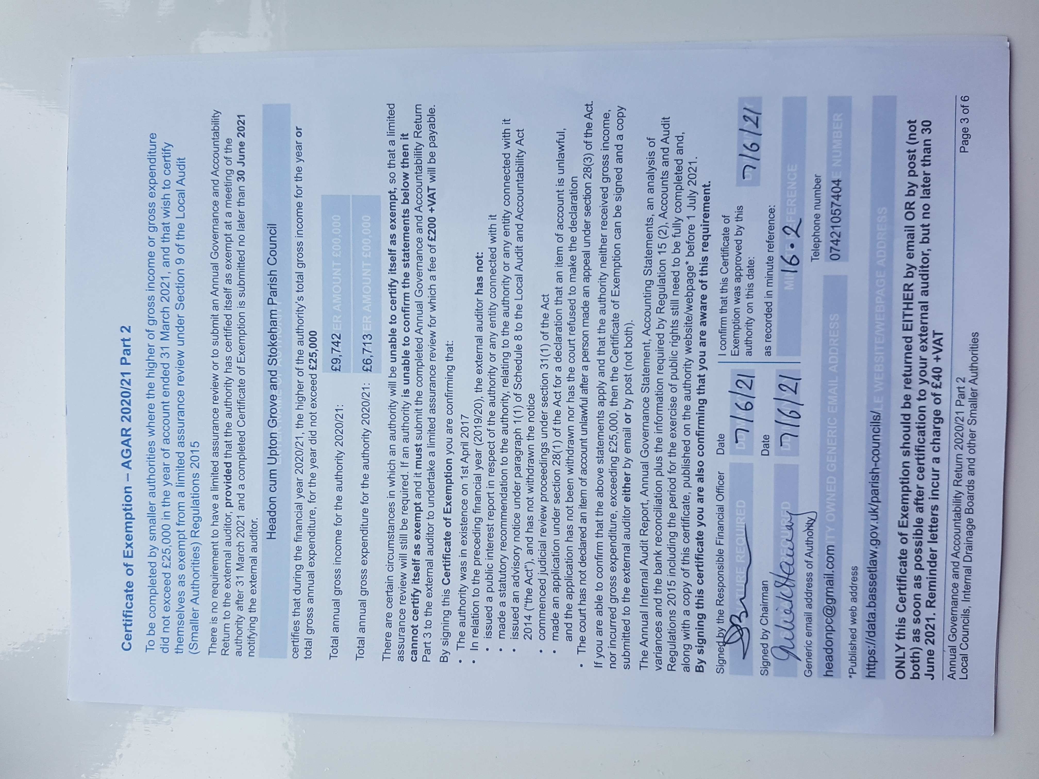
The Local Audit and Accountability Act 2014 sets out a new audit framework for local public authorities which are currently covered by the Audit Commission regime.
Under the new audit framework smaller authorities, including parish councils, internal drainage boards, charter trustees and port health authorities, with an annual turnover not exceeding £25,000 will be exempt from routine external audit.
In place of routine audit, these smaller authorities will be subject to the new transparency requirements laid out in the Transparency Code.
| Date Last Updated: | Monday, April 7, 2025 |
|---|---|
| Update Frequency: | As needed |
| Resource Owner: | Headon, Grove & Stokeham Parish Council |
| Use Constraints: | No conditions apply |
| Geographic Extent: | Bassetlaw district |
| Contact: | Contact the Bassetlaw Open Data Team |